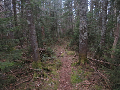
Took a late afternoon/evening hike up the Livermore Trail from the Kancamagus Highway to check on the condition of the trail up through Livermore Pass (2865 ft.), the broad gap between Mt. Tripyramid's Scaur Peak and Mt. Kancamagus. The pass has a remote feeling, just two miles from the Kanc, and the trail through it is rough, wet and primitive. The trail starts diagonally across from Lily Pond.
Not far in from the road the trail passes through an elongated clearing maintained by the Forest Service as the Lily Pond Wildlife Opening.
Approaching Livermore Pass, the trail ascends a steep sidehill section along the east side of a cool hardwood gorge. This stretch is a tough sidehill in winter.
Looking down into the gorge.
A peek at Mt. Carrigain near the top of the climb. When AMC opened the original Livermore Trail (aka American Institute Path) in 1879, it extended from Waterville Valley all the way to the Sawyer River logging railroad at the base of Carrigain. Over the years this trail has seen many relocations.
Vintage AMC guidebooks mention a spot named "Mount Washington Outlook" at the north end of the pass. There is no longer any open view from the trail, but by poking around on the west slope I did find a nice framed vista of Big George.
The headwall of the gorge is steep!
Looking up the headwall beside a mossy headwater.
The final trail pitch to the top of the pass is a rough bouldery section, tedious to descend.
Nasty looking posthole in one of the snow patches lingering on the north side.
Moose sign was abundant in the area of the pass.
A weathered USFS sign marks the height-of-land.
As the trail makes its long traverse through the flat pass, the footing is varied. There are a few good stretches, then a long section like this.
Wet footing is fairly prevalent on the south side of the pass.
The trail crosses this soggy mini-meadow.
Good balance helps for getting through this area.
This high plateau area at the edge of the Sandwich Range Wilderness is very wild, the more so in early evening under a cloudy sky. I was hoping I didn't run into a moose along the trail corridor.
Another soggy section leads to the junction with the Kancamagus Brook Ski Trail, marked by a new sign. The ski trail is way too wet for summer travel, but in winter two beaver ponds 0.3 mile to the NW offer a nice view of Tripyramid.
At this junction the Livermore Trail passes through a wet meadow near the site of the 1930s vintage Flume Brook Logging Camp, operated by the Parker-Young Co. as part of its Waterville operation.
Here is where the trail begins its roadlike character, which continues five miles down to Waterville Valley.
It was too late in the evening to spend time searching for artifacts, but this unidentified piece was right beside the trail.


Steve,
ReplyDeleteNice pics and comments. I descended this way off the Tripyramids the day before you, after stopping in at the Mountain Wanderer to chat. My feet were wet all day. "Tedious to descend" and "soggy" are accurate descriptors for sure. Still - a treat to experience wild country like this. Saw a very large, silent barn owl near dusk. Thought I would see a moose around every corner.
Cheers,
Kris Pieper