Friday, January 29, 2010
MUD POND & MT. PEMIGEWASSET: 1/28/10
The one advantage of a dreary rainstorm and thaw such as swept through the mountains on 1/25 is that once it gets cold again, the snow in the woods firms up and provides good snowshoe bushwhacking. Prior to the rain, the snow off-trail was deep and unconsolidated, making travel slow and arduous.
With colder temperatures this morning, I aimed to sample the off-trail snowshoeing to one of my favorite winter spots: little Mud Pond (a name shared with dozens of other small, mucky water bodies in the Northeast) at the base of the great SE spur of South Kinsman. This would be the continuation of a mini-tour of Kinsman Range water bodies in the past week (along with Kinsman Pond and Lonesome Lake). On the way out I would make the short side trip to the summit of Mt. Pemigewasset.
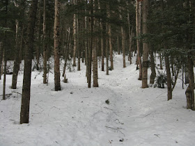
My access route was the popular Mount Pemigewasset Trail, starting from the Flume Visitor Center. The trail was a soildly-packed highway with a few open wet leafy/rocky spots. Microspikes were perfect for the job.
Most of this trail climbs through a fine hardwood forest, featuring some towering old yellow birches.
This trailside boulder is a landmark at about 2200 feet. In this section were some pink ribbons marking future trailwork. Last year the Trailwrights, under the direction of stalwart trail worker Hal Graham, did some major drainage work on this perenially wet stretch.
Near the height-of-land I put on my snowshoes and headed north along the ridge through mostly open woods. As I hoped, the off-trail 'shoeing was excellent, sinking only a few inches into the firm snowpack. The woods continued open much of the way, though I tried a slightly different, more westerly approach than on previous visits and ended up for a while in a flat drainage with blowdown and dense young conifers.
Mud Pond rests in a large spruce-wooded flat area and can be difficult to find. Someone once told me that years ago, as a navigation exercise, students at the AMC/ADK Winter Mountaineering School were told to "find Mud Pond." Despite 4 or 5 previous visits, today I still had a few moments of doubt before spotting the large white opening ahead.
By the time I arrived at the pond, it was snowing steadily; this had moved in earlier than predicted.
It was a far cry from my last visit to Mud Pond, when Garth Dickerman and I enjoyed a glorious February day here, with the view of the Franconia Range fully revealed.
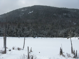
I knew there was no chance of seeing the Franconias on this cloudy day, but I at least wanted to have a clear view of the wild spur of South Kinsman that hulks above the west shore. So I lingered for a while, poking along the boggy shore in either direction on deep, very firm snowpack. (Because of its bogginess, Mud Pond is much less accessible in summer.) This view is from near the north end of the pond.
After a long wait (made possible by temperatures in the high 20s and no wind), the snow finally let up and the sun broke out briefly.
Now the Kinsman spur, spotted with rugged ledges, was clearly seen. It creates a wild and secluded setting for the pond.
On the 2008 trip Garth and I made a steep bushwhack to one of the ledges on the Kinsman spur. We were rewarded with a unique bird's eye view of Mud Pond.
The ledge also had a good view of Mt. Flume and the bowl of Flume Brook.
With clouds obscuring the higher peaks, it wasn't worth attempting the strenuous bushwhack up to the ledges today. Before heading back, I took a farewell shot of the pond from the south end.
During my sojourn at the pond the woods had been dusted with an inch of new snow. There were many moose postholes in this area.
Returning to the Mount Pemigewasset Trail, I made the short climb to the summit, pausing to chat with a descending snowshoer, the only other person on the trail this day. He had once been to Mud Pond and remarked about its seclusion. As I approached the prow-like summit ledge, it was evident that fog had rolled in, mostly obscuring the views.
There was a glimpse of Bog Eddy, the large open swamp on the high plateau south of Mt. Pemigewasset.
I-93 could be seen winding southward into the clouds.
I always enjoy the down-look to the hardwood forest at the base of the mountain. Somewhere below Mt. Pemi, I've heard, there is a small stand of old-growth hardwood.
On the way down the trail, I made several long forays in the untracked snow through the hardwoods parallel to the trail. Where there is adequate cover, conditions are great in the woods right now!
Wednesday, January 27, 2010
NORTHEAST CANNONBALL: 1/26/10
My, how this winter game can change in a hurry! After several weeks of snow-blanketed glory in the mountains, the heavy rain and balmy temperatures on 1/25 came as quite a shock. The next morning showed signs of clearing with breaks of sun, so I headed out to see how the trails and the snow had fared after the deluge. I figured the notches would be the best bets, as they had received the biggest dumping from the early January snowstorm. The plan was to head up to Lonesome Lake, and if conditions looked good continue up the steep climb to the Northeast Cannonball and enjoy some views, cloud cover permitting.
I got a late morning start on the Lonesome Lake Trail.
Where the trail leaves the campground, the storm runoff had cut a channel through the snowpack.
The woods just above the campground are home to some large old yellow birches.
The well-packed snowshoe track survived the rain and was smooth as a sidewalk, with just a few small icy spots. The snow was crunchy with good bite - perfect for the MSRs. Although the heavily used section up to the lake would have been OK for barebooting, beyond that the track was a little softer and snowshoes were definitely needed as the temperature was in the mid-30s. I wore mine car to car.
Up above the second switchback, it looked more like early April than late January. Near here I heard the squawk of a robin; some of them do winter over in the mountains, presumably dining on mountain ash berries and other local fare.
After the steady 1.2 mile, 1000-foot climb to Lonesome Lake, I had earned this favorite view of the Kinsmans across the pond. Although I have crossed Lonesome Lake many times in winter, this was not one of them, not on the day after 2 inches of rain and temperatures near 50!
South Kinsman, with the roof of Lonesome Lake Hut visible below in the woods.
The ledgy face of North Kinsman. Hard to believe these dark-looking peaks are the same as the marvelously snow-crusted summits we saw last week from Kinsman Pond.
To the right I could see my next objective, the Northeast Cannonball.
After skirting the east shore of the pond, the Lonesome Lake Trail crossed a flat area leading to the base of the climb to Coppermine Col. Along the way was a somewhat precarious crossing of a crevassed brook on a narrow, icy log bridge. All the brooks were opened up by the warm rain.
The trail led through some nice open "salt and pepper" woods - a mix of birch and spruce/fir.
The upper Lonesome Lake Trail climbs quite steeply for several hundred feet. In one section the runoff had created a gullied mess of hollow ice, dirt and crusty snow.
Above the steep section the trail approached Coppermine Col through open woods. The snow was littered with crusty chunks of snow that the rain had swept off the "Snow Gnome" trees. The only snow now on the branches was a slight dusting that had fallen overnight.
The Kinsman Ridge Trail junction. From here to the top of Northeast Cannonball is a climb of 350 feet in 0.2 mile - i.e. steep!
Not too far up there's a first view looking back at the rugged W face of Cannon Mountain.
The trickiest spot on this climb is a ledgy "slot" where there's not much to hang onto. It's steeper than it looks in the picture. The MSRs provided good grip here on the crusty snow.
My favorite view from the Northeast Cannonball is from an open spot/blowdown area a short distance SW and downhill from the flat summit crest. From here the Kinsmans are seen rising beyond the nearby top of the Middle Cannonball.
A zoom on North Kinsman. The little ridge that holds in Kinsman Pond can be seen at the base of the summit cone.
South Kinsman and its great, sprawling SE spurs trailing off to the L.
Peering back, there is a peek at Franconia Ridge behind the south end of Cannon.
The SSE view includes the Osceolas, Scar Ridge, Loon and Tecumseh.
Mt. Liberty is to the SE.
Looking south down the Pemi River valley; Mt. Pemigewasset (Indian Head) is just L of center in the foreground.
Back at the E end of the summit crest, a boulder provides a vantage for admiring the impressive bulk of Cannon.
At the start of the steep descent, the world drops away to Coppermine Col.
Approaching the ledgy slot from above. This was a tricky spot on the return trip - I chose to back down through the slot, then turn around and resume a careful forward snowshoe descent, using short firmly placed steps.
Back at Lonesome Lake, I paused to admire late afternoon views of South Kinsman...
...and North Kinsman. From here it was an easy cruise back down the packed highway of the Lonesome Lake Trail.
Friday, January 22, 2010
KINSMAN POND: 1/21/10
The forecast called for sunny skies, and a friend had told me he had been on the Kinsman Pond Trail the previous week, so there would be an old snowshoe track underneath the snow that had fallen since then. John Compton and I figured we would trek up to Kinsman Pond, a gorgeous setting at any time of year, and then head up to North Kinsman for some views. As it turned out, the latter part of our plan was foiled by a frustratingly persistent cloudbank, but the pond provided - eventually - its own rewards.
We started off from the Basin parking area on I-93 and snowshoed up the Basin-Cascades Trail through a few inches of fresh snow, pausing often to admire the scenery along Cascade Brook.
Kinsman Falls was hidden under the ice. Just beyond here we crossed the brook and negotiated the trickiest part of this route to Kinsman Pond, a short stretch of the Basin-Cascades Trail that tightropes along a steep bank high above the brook. Careful foot placement is required in a couple of spots; caution needed if crusty or icy.
Rocky Glen Falls was buried in snow.
Just past these falls we snowshoed up through a small flume.
Turning right on the Cascade Brook Trail (part of the Appalachian Trail), we crossed a heavy-duty bridge built over Cascade Brook a few years ago in a cooperative effort by AMC and the Appalachian Trail Conservancy.
From the bridge Little Haystack was emerging from the clouds, promising a good viewing day. Hah!
After a half-mile on Cascade Brook Trail we turned left on Kinsman Pond Trail, negotiated a crossing of Cascade Brook, and headed up the valley. After a flat stretch, the trail climbed past a nice birch-glade spot.
Farther up we made a short diversion to a snowy ledge atop a cascade, with a view looking down the brook.
Tall spruces overlook the cascade.
We were now breaking trail through 8 to 10 inches of new snow. The snowshoeing was superb. The upper part of this trail is a miserable slippery brookbed rock-hop in summer, but in winter the rocks are covered and the mostly moderate grades makes this an excellent 'shoeing trail, more pleasant than the more popular Fishin' Jimmy Trail route to the Kinsmans.
There was an occasional short, steep pitch, but they don't last long on this trail.
Beautiful open conifers around 3400 feet.
From the Cascade Broook Trail up, there were numerous small conifers bent over the trail. Banging the snow off the branches (to avoid refreshing snow showers), then ducking under or pushing through the scrubby trees, combined with the trail-breaking, made for a slow trip up to the pond.
Rime-frosted trees lined the trail as we drew closer to the pond.
The Forest Protection Area sign assured us we were nearing our objective.
The final approach led through a tunnel of snow-crusted trees. The old snowshoe track disappeared in this wind-drifted area.
Seeking relief from the constant branch-banging and ducking, we dropped down to the south end of the pond. The fog was so thick we could not see more than a hundred feet. These ghost trees were only a few yards away.
We made our way along the east shore of the solidly-frozen pond.
At the north end we ducked back into the woods to the Kinsman Pond Shelter. This marvelously-built, partly-enclosed shelter was completed by the AMC crew in 2007. The last time I was on North Kinsman, in September 2007, I could hear the crew down below, working on the finishing touches.
It was cozy and pretty much snowless inside, a good place to relax and have a late lunch after our four-hour ascent.
We would periodically check outside to see if there was any sign of clearing. Not yet.
We made two forays over to Kinsman Junction while waiting for potential clearing.
We also went across the pond to the west side, at the base of the steep slope of North Kinsman.
An hour and a half later, still no sign of clearing, though there was an occasional fuzzy patch of blue overhead. Several times we considered continuing up to North Kinsman, but with the persistent fog it didn't seem worth the effort. Trip reports from other mountains this day talked of great undercast views from Flume, Moosilauke and other summits. Wonder if North Kinsman was just barely poking above?
Finally, a little before 4:00, there was some real sign of clearing at the pond. South Kinsman began to take shape, looking south down the pond.
And the rugged east face of North Kinsman loomed half-seen through the thinning veil.
Suddenly things came into focus - we could see the pond!
John headed down the pond for a better look.
Finally, the broad dome of South Kinsman was fully revealed.
And the snow-crusted cliffs of North Kinsman came out as well.
More views of South Kinsman. After our two-hour wait, these late afternoon vistas pleased us greatly.
The two Kinsmans together.
We lingered for a while, soaking in the views and snapping photos with benumbed fingers. Eventually we headed down to the south end of the pond, with a view back to the north.
From here North Kinsman towered close overhead.
We finally left the pond at 4:25, knowing we'd be doing much of the descent in the dark. We agreed it was worth it to see the pond and the Kinsmans finally revealed in their wintriest garb. After daylight faded, the light of a half-moon aided our descent. Out on the open brookbed crossings the moonlight was stunning. The stars of Orion sparkled clearly in the eastern sky. We didn't pull out our headlamps until we were halfway down the Basin-Cascades Trail - we wanted to be sure of our footing on the tricky sections along the high bank. Even though we never made it to North Kinsman, we were amply rewarded for today's efforts.