Saturday, October 31, 2009


"UNKNOWN LEDGE" IN THE KILKENNY: 10/29/09

The Kilkenny region in the White Mountains has a strong appeal to hikers who like solitude with their scenery. Beautiful woods (including some of the most expansive birch forests anywhere), lightly trodden trails and several fine viewpoints draw Kilkenny devotees back again and again.

This week I needed to scratch the "Kilkenny itch," and when I proposed a journey to an elusive ledge on the SW flank of "Unknown Pond Ridge," fellow bushwhacking enthusiasts John Compton and Chris Whiton postponed plans for another exploration to come and check this spot out.

This was to be a leisurely day, with fairly short mileage and mostly open whacking through hardwood and birch. After meeting at Appalachia in Randolph, we carpooled for the drive up through downtown Berlin, out Route 110, and down York Pond Road to the fish hatchery and the Unknown Pond Trail parking area near the end of the road. At 10:00 we set out on the Unknown Pond Trail. After an initial half-mile along the grade of the 1890s Upper Ammonoosuc logging railroad, we climbed gradually up the valley of Unknown Pond Brook.


With the leaves down, we had many views of this pretty, cascading stream.


Partway up the valley we headed into the open hardwoods, which became somewhat brushy after the 1998 ice storm opened the canopy. Along the way there was abundant moose sign.


This was very pleasant post-foliage whacking.


Higher up we entered the fabled Kilkenny birches, which filled in these clear-cut slopes after 30,000 acres were burned in a 1903 fire.
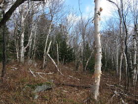


The summer's fallen ferns made for comfortable seating during a break.


Onward and upward, through still more birch glades.


We crossed an interesting jumble of rocks shortly before we plunged into the conifers in search of the view ledge. On the first of three late 1990s snowshoe journeys along this "Unknown Pond Ridge," I failed in my attempt to find this ledge, though I did hit other viewpoints higher up. On two subsequent winter treks, one with Creston Ruiter and another with Cath Goodwin, we found the ledge, but only after considerable searching through rather steep, thick and rough terrain.


This time, we found the ledge fairly quickly, and 2 1/2 hours after we left the trailhead we emerged on its sloping granite expanse.


The morning's clouds were, as predicted, breaking up, bringing us an increasingly sunny day. It took a while for the fog to burn off the Presidentials and Carters, seen in the distance beyond the Crescent Range. What a great slab to hang out on in the warm October sun!


Close by to the west we enjoyed a unique perspective on Mt. Cabot, The Bulge and The Horn.


Cabot's bulk is impressive from this angle.

Chris peers over the edge with The Bulge and Horn above. The slab's grainy granite gave good grip for boots.


A zoom on The Horn, its slopes cloaked in endless birch forest. With binoculars we could spot the table-flat ledge that crowns the summit.


We had an unusual vista of Willard Notch to the SW: North Weeks on the L, South Terrace on the R, the long east ridge of Mt. Waumbek in the back.


The distinctive profile of North Weeks.


The Carters and Presys emerged.


Zoom on the Presidentials, rising beyond the vast basin of the Upper Ammonoosuc River.


Two beaver ponds could be seen in the valley below.


At the back edge of the ledge was a deep crevice. A bad place to drop a camera.


From the edge of the ledge you could peer down to the woods below. Chris made his way down there and said the massive slab was pretty impressive to look up at.


After a blissful 2 1/2 hours in the sun, we headed back into the woods for the descent. John paused to get a picture looking back up the birch-lined slope.


Back down on the Unknown Pond Trail, we made a couple of very short off-trail forays to admire some cascades.


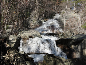
This lovely cascade and waterslide was an unexpected bonus.


John aptly dubbed the lower part a "sheet cascade," where the water slides over a nicely jointed granite slab.


Heading out along the old logging railroad grade on the lower part of the trail. The maps I've seen of the Upper Ammonoosuc RR don't show the locations of the logging camps, but they must be out here somewhere.


On York Pond Road near the trailhead we had a view back up to the south end of Unknown Pond Ridge. Our ledge is just visible on the upper left slope. It was a relaxing and rewarding Kilkenny journey.


Tuesday, October 27, 2009

WHITE MOUNTAIN CROPWALK XXI: 10/25/09

Every fall since 1989, my good friend Mike Dickerman and I, along with several stalwart friends, have tramped through the mountains on the White Mountain "CROPWALK," a hike that raises funds for the anti-hunger programs of Church World Service (www.cropwalk.org). There are thousands of community CROPWALKs around the country, but as far as we know ours is the only one on mountain trails. Over the years our generous sponsors have donated over $46,000 to this worthy cause. Twenty-five percent of that goes to local food banks in Littleton and Lincoln.

Our CROPWALKs have taken us on many interesting routes, from the Mahoosuc Range in the north to the Appalachian Trail south of Mt. Moosilauke, with a number of treks through the Pemigewasset Wilderness. The original route for this year's ramble was to be a circuit around Flat Mountain Pond in the Sandwich Range Wilderness, from Sandwich Notch Road to Whiteface Intervale. However, several inches of rain the previous day (Saturday) made that route ill-advised, as there would be a major crossing of the Whiteface River that could be impassable near the end of the hike.

After some deliberation at a meeting spot in Center Sandwich, we opted for a different route in the same area: up and over Mt. Israel on the Wentworth and Mead Trails, then up the Black Mountain Pond Trail to the pond and back, and finally looping back via the Guinea Pond Trail and Sandwich Notch Road.

Around 8:45 am we gathered at the Mead Base trailhead off Sandwich Notch Road to head up the Wentworth Trail. This year's CROPWALKers included (L to R) Roger Doucette, Mike Dickerman, Thom Davis, Steve Martin, Dennis Lynch and Candace Morrison.


The Wentworth Trail starts out with a steady climb and never lets up very much: 1700 feet up in 2.1 miles to the 2630-ft. summit of Mt. Israel.


The little brook that this trail crosses partway up was running strong. Every stream crossing today required some deft maneuvering, and as expected the footways were very wet much of the way, with water often running down the trail.


A nice cascade beside the Wentworth Trail.


About halfway up the trail brushes by this huge old red oak.


The first outlook on the Wentworth Trail is near the crest of the ridge and looks south over Squam Lake, with Mt. Kearsarge on the horizon on the right.


After a short climb above the viewpoint, the trail rambles along the ridgetop of Mt. Israel through deep spruce forest.


The view of the Sandwich Range from Mt. Israel is second to none. You get a preview from the slightly lower SW summit.


The true (NE) summit is capped by a conical ledge. Thom, who had been partway up Israel a couple of years ago on the Mead Trail during a Pemi Valley Search & Rescue carryout, enjoyed his first visit to the summit.


As is often the case on the north-facing ledges, there was a chilly wind atop Israel.


But the views were spectacular on this sunny late October gem. In this picture on the skyline are (L to R): East Sleeper, West Spur of Whiteface, Mt. Whiteface, Mt. Passaconaway, Nanamocomuck Peak, and Wonalancet Hedgehog. In the foreground are the southern Flat Mtn. (L) and Young Mtn. (R).


To the NE you see Mt. Paugus (L) and Mt. Chocorua (R).

The Tripyramids and West Sleeper rise above the remote Flat Mountain Pond/Lost Pass region, with the northern Flat Mtn. on the L.

Close by to the NW is the massive sprawl of Sandwich Dome.


Under the double summit of Sandwich is a large trailless area of ridges and ravines.


On the left side of Sandwich are the two Black Mountains: the lower left one is 2732 ft., the broad ledgy spur to the right, which is traversed by the Algonquin Trail, is 3500 ft. high. Black Mountain Pond (not visible from here) is tucked into a hollow at the base of the 3500-ft. Black Mtn.


Thom, a geology professor at Bentley College specializing in glacial geology, pointed out a glacially polished outcrop of quartz at the summit of Israel.


Next we headed down the Mead Trail, which provided a moderate and pleasant descent, though very wet in places from the rain. This cascade was just below a brook crossing about halfway down.

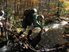
Before heading up to Black Mountain Pond, we made a side trip east on the Guinea Pond Trail to Guinea Pond. We followed a bypass path to avoid two high-water crossings of the Beebe River, and used a flotsam-and-jetsam crossing found by Steve Martin to get over a tributary brook. Here is Dennis high-stepping across.


The shore of Guinea Pond was even wetter and swampier than usual, making it impossible to get near the water. But we still enjoyed a pretty view to Sandwich Dome from the end of the spur path.


Then we had to cross back over the tributary brook. Roger's turn...

Mike makes the final leap.


The Beebe River was flowing deep and fast at the start of the Black Mountain Pond Trail. It didn't look good for making it up to Black Mountain Pond, but a short distance east, where the Guinea Pond Trail crosses, the water was shallower and safe to wade. Candace watches Steve make his way across.


Mike wades through the chilly knee-deep water. Once we were all across, we made a short bushwack to the Black Mountain Pond Trail and headed north through the broad, wild upper basin of the Beebe River.


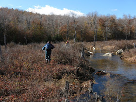
A half-mile up was another crossing of the Beebe, here more of a brook, but still running high. Three of us went out into a beautiful beaver meadow, seeking an easier crossing.

A great sitting rock rises in the meadow. It was tempting to stop here and just hang out in the sun.


The higher Black Mtn. rises north of the meadow.


Above the meadow the trail passes by several cascades on the Beebe - a very scenic stretch of trail.


At 1.9 miles from the Guinea Pond Trail, a side path leads left to little-known Mary Cary Falls.


In high water this is an impressive waterfall, where the river drops over big ledges in a hardwood forest setting.


The best view up to the falls is found by scrambling across to the west side of the brook at the base.


We continued another half-mile up the main trail, with one more brook crossing, to Black Mountain Pond. Six acres in area and 32 feet deep, this pond is crystal clear and rests in picturesque fashion at the base of ledgy Black Mountain. The former shelter on the south side was removed years ago due to overuse. Camping is allowed here, but not within 200 feet of the pond, and some areas are closed for revegetation.


Candace spotted this wet-weather waterfall on a cliff face on the flank of Black Mtn.


A small ledgy island on the SE shore provided a wonderful spot for a late lunch.

Mike surveys the Black Mountain Pond scene.


In the woods up behind the pond we gathered for our traditional group photo displaying the CROPWALK banner.


Heading back down the Black Mountain Pond Trail, there was nice understory color in the beech forest. Golden sun and golden leaves - the essence of October.


As we headed out on the Guinea Pond Trail, we saw this view over a beaver swamp to a shoulder of Sandwich Dome.


Some late foliage on a nearby hill.


Parts of the Guinea Pond Trail were flooded from the rain. Nearly this entire trail follows the bed of the old Beebe River logging railroad (1917-1942).


The final leg of our hike was a 3.3 mile jaunt along the quiet Sandwich Notch Road, and then 0.4 mile up the side road to Mead Base.


The Notch Road has great historic interest, with many signs of dozens of homesteads that were established here by the mid-1800s, only to be abandoned after the Civil War. This cellar hole is right next to the road. Along the road there were also cascades, a beaver meadow, and a crag called Pulpit Rock, where a preacher held forth on Sundays a century and a half ago. A nice conclusion to a great 15-mile hike. Thanks to all who participated in and sponsored the 2009 CROPWALK!