Wednesday, June 27, 2012


POKING AROUND NEAR CAMP 8: 6/26/12

Carol and I took a walk partway out on the Lincoln Woods Trail to do a little exploring around the area of Camp 8 (from the East Branch & Lincoln Railroad) and the lower Osseo Trail. Our visit to this area was inspired by the recent publication of a revised and expanded edition of Bill Gove's book, "J.E. Henry's Logging Railroads."

Camp 8 was in use from 1902 to 1945, spanning both the J.E. Henry and Parker-Young eras of the East Branch & Lincoln. The brushy clearing of this site is right beside the Lincoln Woods Trail, just north of the Osseo Trail junction. A beaten path leads a few feet to a sled runner partly buried in vegetation.


Before exploring along the lower Osseo Trail, we went another quarter-mile north to the riverside spot on the Lincoln Woods Trail, where a remnant piece of rail is found.

The fine view upstream to Bondcliff and its pointy south spur was largely obscured today.

Looking downstream along the East Branch.


Then we headed up the lower, nearly flat section of the Osseo Trail to look for signs of the narrow-gauge incline railway constructed in 1901 by J.E. Henry. Farther up, the trail follows one of the switchbacks of this short-lived line.


The trail follows Osseo Brook up its valley.

We found some interesting stuff poking around in the woods on either side of the trail. (Note that it is illegal to remove any historic artifacts from the National Forest.) There were also some rusting bed frames lying around here.


Not sure what this item was used for.


This blurry photo shows a short piece of rail that we assumed was left over from the narrow gauge line.


Another unidentified artifact. Carol noted that the loggers would have a pretty good laugh about the way we and other folks get so excited about the metal junk they left behind.


History buff John Gutowski thinks this metal band may have been part of the narrow gauge operation.


Carol and I tried to envision where the bed of the narrow gauge line ran through the woods. This looked like one possible location.


Another piece of hardware in the woods.

Wonder what was dispensed from this container? It was an interesting way to spend a couple of hours on a cool, cloudy morning.


Wednesday, June 20, 2012


A RAMBLE ALONG THE EAST BRANCH: 6/18/12

  A summer tradition for Carol and me is a longish, leisurely walk into the valleys of the Pemigewasset Wilderness, most often up the main valley of the East Branch of the Pemigewasset River. That was the plan on this sunny, comfortable June day, using the Pemi East Side Trail. This trip always rewards with river and mountain views, fine woods, and great spots to lounge in the sun. This year we would also have a chance to see much damage and stream rearrangement from Tropical Storm Irene.


The Pemi East Side Trail is also known as the East Branch Truck Road, for it was originally constructed in the 1940s to haul timber out of the valley by logging truck. At that time the Pemi area was National Forest land, but the Parker-Young Co. (successor to the J.E. Henry Co.) retained timber cutting rights. Today the first 2.8 miles is still a narrow gravel road, occasionally traveled by a Forest Service vehicle, while inside the Wilderness the road is now mostly a narrow footpath.


A mile in, Irene washed out a large culvert at a brook crossing, and cut the road in two. The Forest Service plans to build a bridge here.


Just beyond is a badly eroded stretch of the old road, which must have had its own stream running down it during Irene.


A nice birch-lined stretch.


At one spot I made a short bushwhack to a high bank, where I found a good view up the valley to the handsome peak of West Bond. Irene opened some neat views, but view-seekers should stay back from the edge as the banks are severely undercut.


Zoom on West Bond.


Just before you reach the Franconia Brook tentsites, an opening beside the trail offers a view west from atop a high, steep bank. In this photo you see the ridge traversed by the Osseo Trail on the L (can you guess where the ladders are?) and Mt. Flume on the R. From here you can also see Whaleback Mountain and some of its cliff-faced spurs.


Right before the gate and sign marking the Pemigewasset Wilderness boundary, a short spur road drops to the East Branch opposite its confluence with Franconia Brook. There were once some large step stones here, and the river crossing was marked and sanctioned by the Forest Service, but Irene swept away the step stones and gave the entire area a whole new look. The Forest Service no longer encourages crossing here. Carol watched a group of young backpackers ford the river here; one young man was in the water up to his waist. 


This is what that crossing looked like, pre-Irene.


We returned to the trail and headed into the Pemi.


Our next stop was one of our favorite spots, the "Ranger's Pool,"  where there are ledges, old cedar trees such as those shown here, and a beautiful pool in the river.


The ledges are in the shade in the morning.


Downstream you can see Whaleback Mountain and its spurs. We spent a lazy hour here; Carol did some wading in her Crocs.


Continuing on the trail, we soon passed this interesting boulder.


Major bank erosion from Irene.


Riverside ledges right along the trail - another great spot.


Downstream to Whaleback.


Irene did a major rearranging at the crossing of Cedar Brook.


Hiking deep into the Pemi woods.


Farther down the trail, we went out to a neat rocky outwash spot along the river.


Carol had fun wading around out here.


A stark sentinel along the shore.


Eventually we headed back along the East Side Trail. At one point I made a short bushwhack to a favorite view of Bondcliff and its sharp southern spur.


More ledges sloping into the East Branch.


We returned to the Ranger's Pool for another sojourn. There was a sweet breeze here, with many Tiger Swallowtail butterflies fluttering by. On both visits here, we were puzzled as to what happened to the small ledgy cascade that used to be here. Was it demolished by Irene?


Here is the cascade, pre-Irene.


No cascade here now.


Summertime, and the livin' is easy...


A very peaceful place.


On the way back, we followed the Pine Island Trail, which parallels the East Side Trail along the river and provides some very nice walking. Carol and I had adopted this trail last July, but Irene placed two sections of it into the river. It is currently closed, but is scheduled to be reopened this summer when two relocations are completed.  The relos are marked by blue flagging, those sections are bushwhacks right now.


Owl's Head Mountain in the distance.


Flood debris in the woods along one of the relocations.


Several sections of the trail survived the storm just fine.


One of the spots where the trail was taken by the river.


Another spot where the trail used to go; South Twin Mountain is seen in the distance. We'll be happy to see this very attractive  trail reopened.


Tuesday, June 12, 2012


WEST SLEEPER SLIDE - WITNESSING THE POWER OF TROPICAL STORM IRENE: 6/11/12

I first glimpsed the surprising new slide on the NE side of West Sleeper from a distant viewpoint on Table Mountain back in late April. A bit of research determined that it most likely fell during Tropical Storm Irene on August 28, 2011 - one of only a few slides that occurred in the Whites during that amazing burst of rainfall.

Last week I climbed Potash Mountain for a closer look at the slide, which fell into the big side valley between the Sleepers, off the main valley of Sabbaday Brook. A few winters ago Cath Goodwin and I snowshoed up this side valley to the col between the Sleepers, and found mostly open woods after an initial tangle of hobblebush. Sabbaday is one of my favorite valleys to walk in the Whites, so on my next free day I headed in to have a look at the new slide.

Mine was the only car in the lot as I set off on the Sabbaday Brook Trail in the morning.


The first 0.3 mi. of the trail, up to the side loop to Sabbaday Falls, is graded gravel. I decided to skip the falls on the way in, and visit them on the way out.

Beyond the falls, at a place where the trail splits around a loop brookbed, Irene had done some damage.


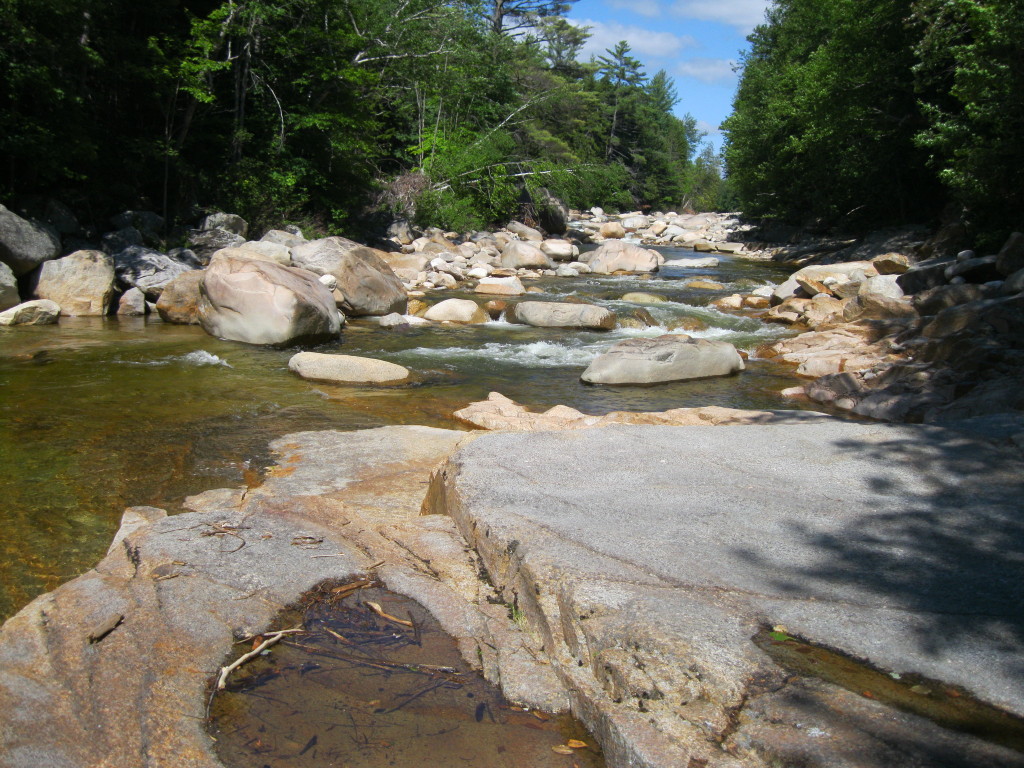
The water's been fairly high of late, but the three big crossings of Sabbaday Brook weren't difficult, I only had to use an occasional underwater rock. This the first crossing.


The second crossing is wide and shallow.


All along the trail there was evidence of excellent drainage cleaning by trail adopter Scott Wood.


The trail enters the Sandwich Range Wilderness shortly after it turns right onto an old logging road on the east side of the brook, which is followed for 1.5 mi. This sign was in the wrong location for a few years and was recently moved 0.2 mi. to the north.


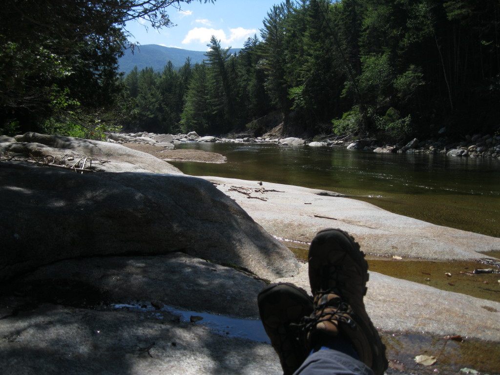
A look upstream along Sabbaday Brook.


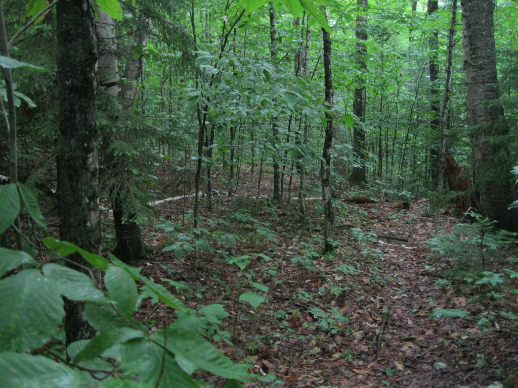
Much of this section of Sabbaday Brook Trail provides mellow, pleasant walking.


More of the same. Love this trail.


Shortly before the 4th crossing of Sabbaday Brook, I poked around the site of the old Monahan logging camp, part of the Swift River Railroad operation (1906-1916). There was never a railroad spur up Sabbaday Brook, only tote roads. From this old hanging bucket, I followed a trace of a tote road away from the camp area, hoping it would lead across to the valley I wanted to bushwhack up (Cath and I had followed an old road partway up on our snowshoe bushwhack). But it veered off into a different ravine and I ended up bushwhacking across the slope.


The bushwhack up the valley was mostly through a sea of hobblebush. It was much easier in winter. Up to this point it had been a mostly bug-free day, but now the circling squadrons of black flies were on the attack.


I saw daylight over by the brook, but knew I couldn't yet be at the slide. A closer look revealed a swath of destruction along the brook, a tangle of trees torn and ripped and carried away by the slide. As it turned out, this was 0.2 mi. downstream from the base of the slide.


In another 0.1 mi. I dropped down to the brookbed at a point where it became mostly rocky rubble. Downstream was a heaping helping of "slide salad."


The rubble along the brookbed provided much easier going than the hobblebush-infested woods, and made for an exciting approach to the slide.


Nearing the slide, part of the western slope of East Sleeper could be seen ahead.


After scrambling over some debris, I arrived at the base of the slide, where it made a 90-degree turn down the brookbed. Imagine the roar this must have made as the huge mass of debris came crashing down. It reminds me of this passage from the book, "Chocorua's Tenants" (1895), by Frank Bolles, the naturalist-writer whose favorite haunt was the Sandwich Range. Here he describes the great Downes Brook slide on Mt. Passaconaway, which fell more than a century ago one valley to the east:

"Ah, what sound is that of rending.
Crushing, crashing, splintering timber?
Hear the groans of breaking spruce trunks,
Hear the moans of straining fibres,
Hear the roar of falling boulders
Bounding down the endless ledges.
All of Passaconaway's bulwarks
Seem to break: before the storming."


When I looked up at the slide, I was stunned by how wide and massive it was. The oblique view I had from Potash didn't reveal the full extent. Wow!


I scrambled up to a shelf above the brookbed. If anything, the slide looked even more impressive from here. It fanned out in a hurry over a fairly short distance.


I clambered steeply up the packed gravel and rock for some views. From the lower part, I could see (L to R) Mt. Tremont and Owl Cliff, Carter Dome and Rainbow Ridge, Bartlett Haystack, the Baldfaces, Potash Mountain, and "South Potash."


Higher up, I could see part of Bear Mountain between Potash and South Potash, and to the R of South Potash were Big Attitash Mountain, Table Mountain and Kearsarge North. Even managed to get a boot shot in on the slide.


A closer look at the Potash peaks.


Looking across the slide. Despite the swarms of black flies, I managed to spend about an hour and a half here. An amazing place.


Mostly tall hobblebush on the return whack as well, with an occasional open stretch such as this.


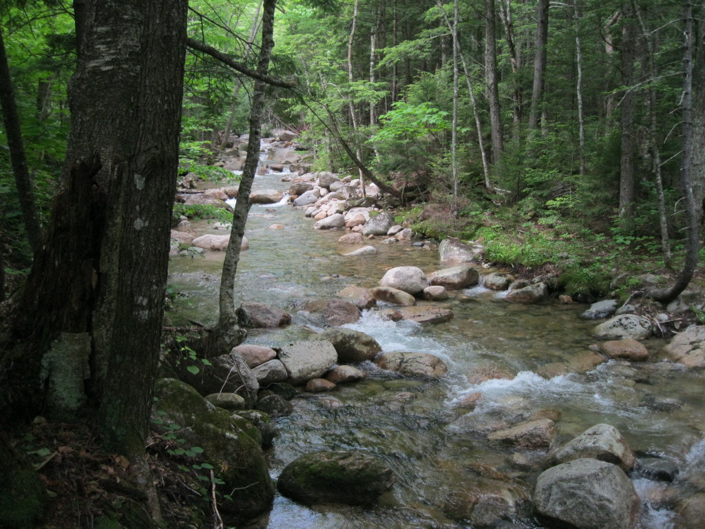
The brook that drains the slide and the valley between the Sleepers, near where it joins Sabbaday Brook.


A pretty meadowy spot on Sabbaday Brook Trail above the 4th crossing.


A sled runner beside the trail near the old Monahan logging camp.


Heading back down the Sabbaday valley, you get a few tiny glimpses of the Fool Killer looming to the west. It's much more prominent with the leaves down.


Nice spot for a break along the brook.


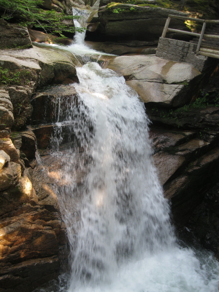
It's a lousy photo, but Sabbaday Falls was in good flow.


Basalt dike in granite ledge below the falls.


Pothole below the falls, an interesting feature to cap off a memorable day in the Sabbaday Brook valley.